In 10 months, I never missed a flight or a bus, never had any tour or hotel stand me up, and never got sick for more than a day or two.
In the last month, I’ve been mugged (well, they tried), had two busses and one hostel stand me up, missed two flights, and woken up with a fever if 105.8 (giardia).
So it’s a good thing I’d planned to be home for Thanksgiving.
In the words of Charlie Robison,
“So I’m leaving for the last time, honey
I’m never more to roam
I’m gonna pack my bags a little heavy this time
Gonna head my ass back home.”
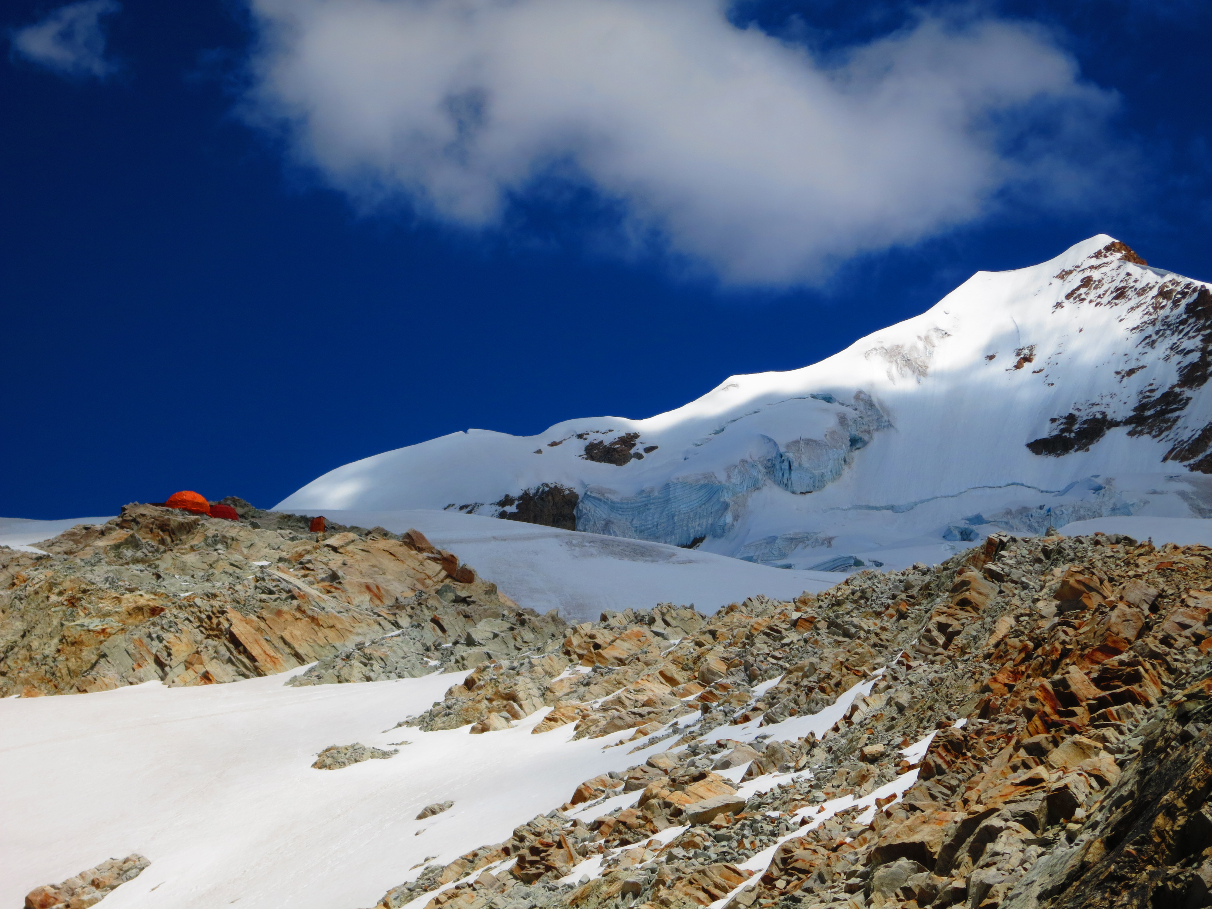
Huayna Potosi, just outside of La Paz, Bolivia stands 20,090 feet (6,088m) tall. If it were in North America, it would be second only to Alaska’s Mt. McKinley. At the summit, the air density is more of less half that of sea level, meaning you’re taking about two breaths for one at sea level. Having said that, altitude alone does not difficulty make. Fitz Roy on the Argentine/Chilean border, for example, is considered one of the hardest climbs on the planet despite standing less than 12,000 feet tall. Huayna Potosi, on the other hand, is considered one of the easier 6,000m summits. You have some options on the route, so may choose to avoid vertical ice climbs altogether. I’d never done anything like this before, so it looked like fun.
Well, it isn’t. It’s cold. It’s hard to breathe. It’s uncomfortable. You have to wake up at midnight and hike in the dark and cold and wind. I was so oxygen-deprived at the top that I don’t remember the ascent. I had the worst headache of my life and my nose bled for 10 days afterwards. The air pressure is so low that your body swells, so much so that my watch strangling my wrist looked like a wedding band worn for 40 years. If this were an airplane, the emergency oxygen masks would have dropped from the ceiling 10,000 feet ago.
No one enjoys this, except masochists. Then there are the charlatans, who make up the majority of climbers, who put themselves through this lunacy only to prove–well, to prove what, exactly? That they are more willing to abuse themselves in pursuit of otherwise meaningless goals? That they are capable of going where sane people don’t even have the desire to go? These idiots go around saying things like (I kid you not), “you haven’t lived until you’ve climbed to 6,000m.” Nonsense. In fact you haven’t really known death until you’ve climbed to 6,000m, and you’re a better, healthier, saner person for it.
Don’t let the smile fool you, that’s just the hypoxia-induced delirium.
Whatever it is that makes people do this, congratulations, you can keep it, and good luck to you. As for me, I’m sticking to hiking. My climbing career is over as quickly as it began. And the next time I want to starve my body of oxygen, I’ll just have someone choke me out.
The dog climbs everyday, usually to the summit. I have no idea why.
Safari, Gray Beck-style, consists of renting the cheapest car you can find, driving to Kruger National Park for one night/one morning, and spending the day racing up and down dirt roads at 10 times the posted limit. Anytime you see a car stopped, pull up in a cloud of dust, “poach” the other tourists finds, and move on to the next one. In this way, you can see the “Big Five” (lion, leopard, elephant, rhino, and cape buffalo) in a single morning, plus lots more.
This slideshow requires JavaScript.
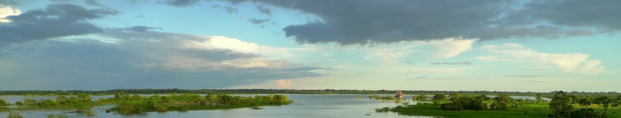
This, Ann Beck, is the great, grey-green, greasy Limpopo River.
And if you’ve never seen the “Battle at Kruger”, one of the most-watched YouTube videos of all-time, there’s no time like the present. Stick with it to the end, I promise everything turns out okay. But it might bring you to tears.
It’s low water season here, so you don’t get the full effect. During high water, the entire cliff face is a single sheet of water, the world’s largest.
As it is, the most remarkable thing is that the constant mist and scorching African sun make for rainbows everywhere.
There isn’t exactly a good route for traveling through the heart of Africa. It’s pleasant enough along the eastern coast, but the infrastructure through the Great Rift Valley is abysmal. In Burundi, I learned of a boat that plies the shores of Lake Tanganyika. The boat, rumor has it, runs twice monthly from Kigoma, Tanzania to Mpulungu, Zambia. But it’s recently been laid up, for months, in dry-dock. In theory, it leaves every other Wednesday, some time in the afternoon. My plan is to head south from Burundi on a Wednesday morning, so this boat might be just the ticket.
The bus departs Bujumbura at 6am, scheduled to arrive Kigoma at about noon. After traversing the worst roads I’ve ever seen for the Burundi section, we enter Tanzania. Within an hour, we’re stopped by the police three times to check our papers, i.e. demand bribes. (I don’t pay them, as a matter of policy. I strictly obey the Foreign Corrupt Practices Act, and if I were to bribe a foreign official, it would be to allow me to do something that isn’t allowed, not something that is.) At 3pm we arrive Kigoma, on the eastern shore of Lake Tanganyika. It was here, on 10 November 1871 that the New York Herald’s Henry Morgan Stanley finally found Dr. David Livingstone, out-of-contact for almost 7 years, and spoke the immortal words, “Dr. Livingstone, I presume?”
Son-of-a-bitch, the boat is here, and in the water! The fastest motorbike ride in history takes me to the port at 350pm. She’s scheduled to sail at 4, so I book a cabin heading south to Zambia, and off we go.
The boat, the “MV Liemba”, it turns out, is rather famous. It was brought overland by the Germans and launched in 1915. With the outbreak of World War I, and finding themselves hard-pressed by a British expeditionary force, the Germans scuttled it in 1916. If you’re read or seen “The African Queen”, you may recognize some similarity–the Liemba was the inspiration for CS Forester’s story. In 1924, after 8 years on the bottom of Lake Tanganyika, the Liemba was re-floated by the British. With occasional repairs, the ship still runs today, 99 years after launch, and having spent 8 years on the bottom of a lake. Unbelievably, everything is original, including the diesel engines.
Most of the other expat’s were boat enthusiasts, rather than some guy who stumbled on to it. In fact, one group was making their second trip to Tanzania to attempt to catch it. Lake Tanganyika is the second-largest freshwater lake on the planet, and runs 418 miles, north to south, so we’re going to be here for while–three days and nights, if everything goes according to plan. The capacity is said to be 600 people, and the Captain assured me that there were no more than 350 people on board. I personally counted more than that on the forward section alone. I’d bet my paycheck there weren’t less than 1,000 people on board, taking up every single inch of horizontal space. Each time I tried to leave my cabin, the door wouldn’t open because a family would be sleeping immediately outside.
This slideshow requires JavaScript.
But don’t worry about safety, there’s life boat space for a least a couple dozen, and they’re even ready for fires (“fire horse”) and oil spills.
We didn’t leave Kigoma until almost 6pm, by which time we’d accumulated all the baggage of Xerxes’ Myriads–everything from bananas and pineapples to flip-flops to motor oil to bottled water to motorcycles to glass lamp chimneys to Lady Jelly to something called Sufi–whatever it is, we carried a lot of it.
This slideshow requires JavaScript.
There are no port facilities at the intermediary stops, so the boat is anchored and canoes ferry cargo and passengers to and fro, including at night. It’s a dangerous proposition, especially with the canoes battling for best position, so it was nice to know that when I debarked, I’d be stepping directly on terra firma.
This slideshow requires JavaScript.
Unbeknownst to us “muzungus” (essentially African for “gringo”), one of the passengers was a bride-to-be being delivered to the wedding party. She’s the one with her face covered, in strict observance of local tradition.
I’m going to try to avoid going on about the Rwandan genocide–the topic has been covered more thoroughly and more expertly elsewhere. I’ll only say that Rwanda today is probably the cleanest place in Africa and is absolutely stunning, and I can’t recommend it highly enough. That said, I have some lingering suspicions about how well the emotional wounds seem to have heeled. Maybe it’s that life is short in Africa, and so all timelines are compressed. But maybe there’s still something lingering beneath the surface. It isn’t for me to say, or even for me to know. But everyone I meet here over 40, I immediately think, “And exactly what were you doing in 1994?”
Burundi has a similar feel, but the infrastructure is in much worse condition, lacking as it does the enormous and ongoing influx of foreign aid enjoyed by it’s northern neighbor. National borders don’t align with ethnic identity here, and there have been large refugee movements over the decades, so there isn’t exactly a distinct culture between southern Uganda, Rwanda, Burundi, and eastern Congo.
I’m primarily passing through Burundi, but while I’m here, I thought I should have a look for Gustave, the famous killer crocodile. If you’re not familiar with Gustave, he’s a 25 foot long Nile crocodile, notorious for killing over 300 humans along the banks of the Rusizi River. He’s escaped numerous attempts at capture, and bears the scars of numerous bullet wounds. Lest you think this is a joke, well, I can’t vouch for the number of dead, but the crocodile is very much real and very much alive. Unfortunately, (or fortunately, depending on your perspective), Congolese refugees, the Cantonese of Africa, have eaten most of the crocodiles here, though hippos remain abound.
The concrete structure, formerly covered with fencing, was built in an effort to capture him. According to the locals, he’s moved south down Lake Tanganyika and now resides in Zambia. We weren’t able to confirm this, but there is no sign of him along the Rusizi.
A few kilometers away, you’ll find the border with the Congo. Much of the traffic to and from the border is UN peacekeepers, because of the ongoing civil war in eastern Congo. Congo is easily one of the least functional states on the planet, and it seems to be getting worse–war in the east, Ebola in the west, and so it goes.
Perhaps you would think that with all of these problems, including the battles taking place literally within hearing distance, the border would be tightly controlled. You would be wrong. It’s an ordeal to get a visa for Congo, but we simply told the border agents (on both sides) and the Ebola checkpoint personnel that we worked for Oxfam and wanted to cross over for a little while–no passports, no stamps, no nothing, just all handshakes and smiles.
When we re-entered Burundi, my driver (unnamed and faceless in the photos, for reasons that will become clear) asked whether I wanted to see the “smugglers crossing”. 6km north of the primary border crossing, down a typical red dirt African road, is a much smaller crossing, manned by a single guard on each side. It’s here that contraband goods cross, as well as guerilla fighters from time to time. The nameless driver, it turns out, moonlights as a beer smuggler (Amstel is brewed under license in Burundi) and so we crossed into Congo for a second time, this time with only a passing wave to the border guards. Earlier in the week, the driver had encountered guerillas here, so we didn’t stray far.
As for Ebola, well, Congo is a big place, and they’ve had only a handful of cases in the western part of the country. On the drive back, we drove past Burundi’s principle biohazard waste incineration facility, i.e. they truck it out into a field and light it on fire. So that’s reassuring, at least.
Between Uganda and Congo (Democratic Republic of Congo, not the Republic of Congo) lie thru Rwenzori Mountains. Behind Kilimanjaro and Mt Kenya, these are the only permanently snow-capped peaks on the continent. But there are many fewer visitors here, which we counted as a positive. It’s also rainy season here, which we did not count as a positive.
There isn’t much wildlife to see here, apart from the giant earthworms and slugs as big around as my thumb.
It didn’t rain the entire time, but it felt like it did. It was cold and miserable and otherwise wonderful, traipsing through mud up to our ankles, or sometimes our knees. Evenings were spent playing cards wearing our sleeping bags and clutching hot water bottles.
The landscape here is unlike anything else I’ve ever found. It rains so frequently, that the mountain is thick with what are essentially alpine swamps. The whole thing is marshland, but steep–how the mountain manages to hold the water, instead of disintegrating into landslides, is beyond me. But it is beautiful. It’s one of those things where we complained the whole time, but knew we’d miss it as soon as we finished. And so it was.
Before we left, our guide explained to us not to step in “beautiful places.” It took me a day or two to figure out what he meant by that, but I learned–you looked for rocks, or sticks, or plants, or anything else that hadn’t sunk. You could put your face 6 inches from this beautiful alpine meadow and swear it was as firm as a putting green. But the first step onto will sink you in above the knee.
This is the Mutinda Lookout, at just over 13,100 feet.
And this is what it looks like when you can actually see. (Imagine me in place of the random guy whose picture I stole on the internet.)
This is real trekking here, with tents, boiled water, the whole get-up. Although the water, even boiled, wasn’t the cleanest you’ll find.